Description
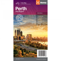
Perth City Streets & Suburbs Map 662
Perth City Streets & Suburbs Map 662 is revised and updated and includes detailed street level mapping of Perth and surrounding suburbs at a scale of 1: 25 000 with coverage from Westminster in the north, Coolbellup in the south, Maylands in the east and along the coast from Trigg in the north to Fremantle in the south.
There is also Perth suburban coverage at a scale of 1: 100 00 with coverage from Bullsbrook in the north, North Dandalup in the south, The Lakes in the east and along the coast from Quinns Rocks in the north to Mandurah in the south with insets for the towns of Pinjarra and Yanchep.
This folded map it is a great tool when travelling in and around the Perth region and for planning.
Waterproof & tear-resistant.


Reviews
There are no reviews yet.