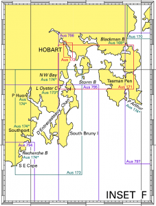
Tasmanian Charts Use the chart indexes on this page to find your charts. Scroll down to find links to the charts below the indexes. AUS 163 Chart – TAS – Approaches to Burnie AUS 164 Chart – TAS – Approaches to Devonport AUS 167 Chart – TAS – Port Dalrymple AUS 168 Chart – TAS – River Tamar – Long Reach to Launceston AUS 169 Chart – TAS – Plans in Tasmania (Sheet 3) AUS 170 Chart – TAS – Mercury Passage (Maria Island) AUS 171 Chart – TAS – Hobart to Norfolk Bay AUS 172 Chart – TAS – Port of Hobart AUS 173 Chart – TAS – D’Entrecasteaux Channel AUS 174 Chart – TAS – Plans in Tasmania (Sheet 4) AUS 175 Chart – TAS – Spring Bay Including Triabunna AUS 176 Chart – TAS – Port Davey including Bathurst Harbour AUS 177 Chart – TAS – Approaches to Macquarie Harbour AUS 178 Chart – TAS – Plans in Tasmania (Sheet 2) AUS 179 Chart – TAS – Plans in Tasmania (Sheet 1) AUS 4074 Chart – Southern Ocean – Cape Darnley to Tasmania AUS 4601 Chart – South Pacific Ocean – Tasman Sea – New Zealand to SE Australia AUS 4602 Chart – South Pacific Ocean – Australia to Northern New Zealand and Fiji AUS 4644 Chart – Southern Ocean Cape Otway to Cape Howe including Tasmania AUS 766 Chart – TAS – Mistaken Cape to Wardlaws Point AUS 767 Chart – TAS – Wardlaws Point to Eddystone Point AUS 790 Chart – TAS – Stokes Point to Rocky Cape AUS 791 Chart – TAS – West Point to Granville Harbour AUS 792 Chart – TAS – Trial Harbour to Low Rocky Point AUS 793 Chart – TAS – Low Rocky Point to South West Cape AUS 794 Chart – TAS – South West Cape to South East Cape AUS 795 Chart – TAS – South Cape to Storm Bay AUS 796 Chart – TAS – Tasman Head to Cape Frederick Henry AUS 797 Chart – TAS – Tasman Island to Mistaken Cape AUS 798 Chart – TAS – Eddystone Point to Stony Head AUS 799 Chart – TAS – Stony Head to Rocky Cape AUS 800 Chart – TAS – Furneaux Group (Flinders Island)