
Description
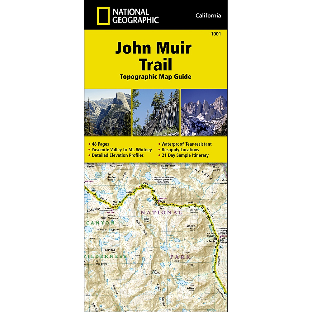
John Muir Trail Map
National Geographic’s John Muir Trail Map and guide is an indispensable tool for navigating one of the most famous trails in the United States.
The John Muir Trail (JMT) is a premier long-distance hiking route stretching 340 km through California’s rugged Sierra Nevada mountain range. Named in honor of the famed naturalist and conservationist, the trail traverses three major national parks – Yosemite, Kings Canyon, and Sequoia – along with two national wilderness areas.
Starting at Happy Isles in Yosemite Valley, the route winds past sweeping granite canyons, pristine alpine lakes, and high-mountain passes before terminating at the summit of Mount Whitney, the highest peak in the contiguous United States at 4,421 meters.
Thru-hikers typically complete the trek southbound over two to three weeks between July and September, tackling more than 14,000 meters of total elevation gain. Renowned for its reliable summer weather, dramatic alpine scenery, and wilderness isolation, the JMT stands as one of America’s most iconic backpacking adventures.
Features:
- Expertly Crafted: Researched in partnership with local land management agencies.
- Topographic Maps: Features the John Muir Trail highlighted and centered on every page for easy tracking.
- Elevation Profiles: Includes detailed trail profiles on each map page to visualize elevation changes.
- Resupply Chart: Details shipping addresses, contact info, distances, and available services for every resupply point.
- Trail & Safety Information: Packed with wilderness safety tips, historical background, a waypoint table, and key points of interest.
The maps start at the northern terminus in Yosemite Valley and progress along the ridge of the Sierra Nevada, past Devils Postpile, and end at the highest point in the lower 48 on the top of Mount Whitney. Along the way you will pass through; Yosemite National Park, Ansel Adams Wilderness, Devils Postpile National Monument, John Muir Wilderness, Kings Canyon National Park, and finally, Sequoia National Park and Mount Whitney. A 21-day sample itinerary is included as well.
Every Topographic Map Guide is printed on “Backcountry Tough” waterproof, tear-resistant paper. A full UTM grid is printed on the map to aid with GPS navigation.
Other features found on this map include: Ansel Adams Wilderness, Bridalveil Fall, El Capitan, Illilouette Falls, Inyo National Forest, John Muir Wilderness, Kings Canyon National Park, Lake Thomas A Edison, Lower Yosemite Fall, Middle Palisade, Mount Agassiz, Mount Darwin, Mount Muir, Mount Pinchot, Mount Powell, Mount Ritter, Mount Russell, Mount Tyndall, Mount Whitney, Mount Williamson, Nevada Fall, North Palisade, Ribbon Fall, Ritter Range, Sequoia National Park, Sierra National Forest, Sierra Nevada, Split Mountain, Upper Yosemite Falls, Vernal Fall, Yosemite National Park, Yosemite Valley.



Reviews
There are no reviews yet.