Description
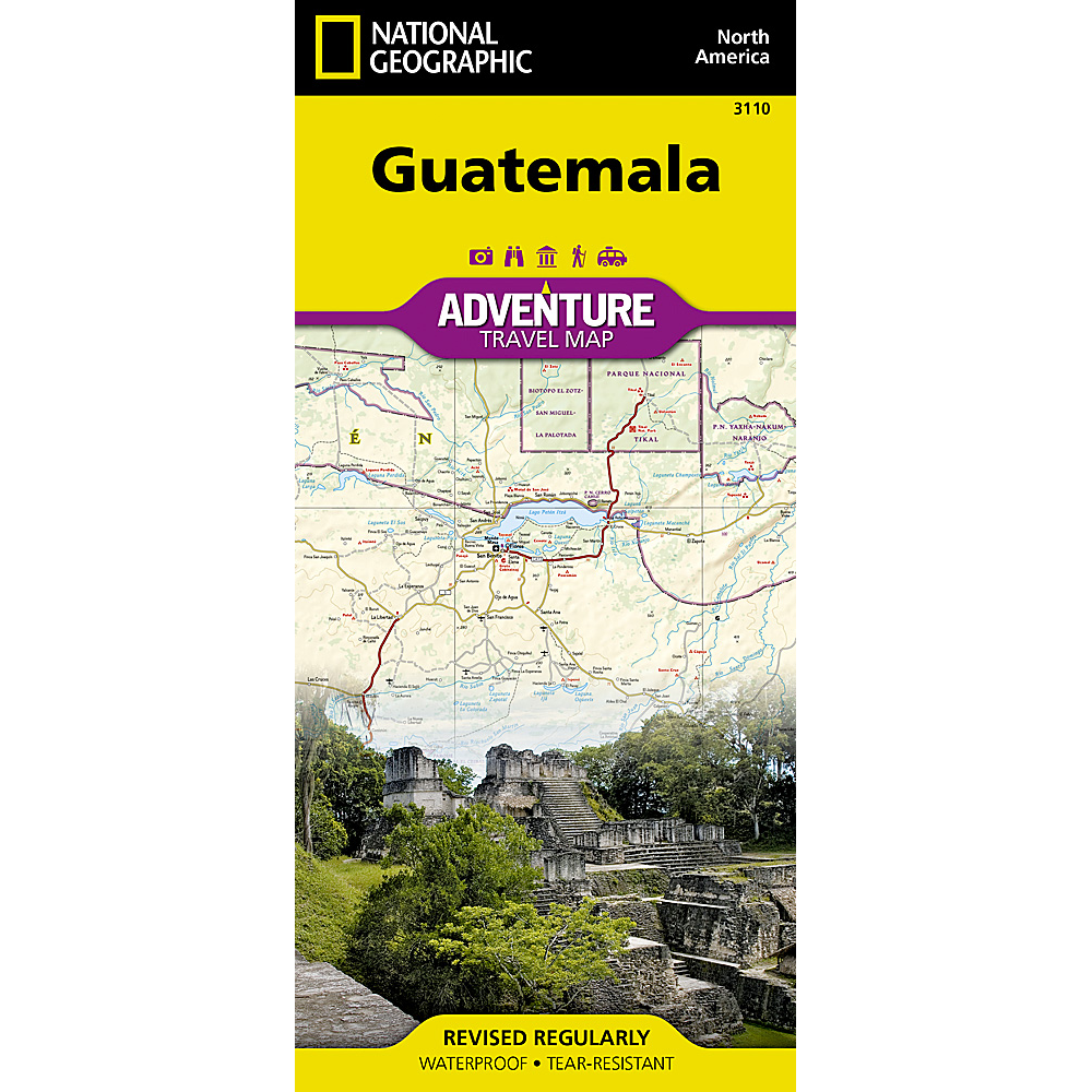
Guatemala Adventure Travel Map
National Geographic’s Guatemala Adventure Map is the most comprehensive map available for travelers exploring the country’s rich cultural heritage and diverse natural beauty.
Comprehensive travel map covering Guatemala’s cultural highlights and natural landscapes, showing clearly marked road network with distances, including:
- Major highways
- Secondary roads
- High-clearance roads and tracks for off-road exploration
- Easy-to-use index of cities and towns
- Includes topographic detail and key points of interest
- Additional travel info shown:
- Airports and airstrips
- Ferry routes
- Railroads
- Border crossings
Highlights hundreds of destinations such as:
- National parks and protected areas
- Archaeological sites
- Caves, beaches, coral reefs and shipwrecks
- UNESCO World Heritage Sites
Map Coverage
Front: Northern Guatemala plus bordering regions of Mexico and Belize, including:
- El Mirador
- Tikal National Park
- Flores on Lake Petén Itzá
Reverse: Southern Guatemala and surrounding borders (Mexico, Honduras, El Salvador, Belize), featuring:
- Pacific coastline and Gulf of Honduras region
- Antigua (World Heritage site)
- Lakes Atitlán and Izabal
- Pacaya Volcano
- Guatemala City
Every Adventure Map is printed on durable synthetic paper, making them waterproof, tear-resistant and tough – capable of withstanding the rigors of international travel.


Reviews
There are no reviews yet.