Description
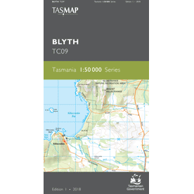
Blyth 1:50,000 Topographic Map
The Blyth map covers the northern part of Flinders Island, along with the outlying Inner and Outer Sister Islands. Flanked on the eastern side by the seemingly endless Foochow Beach, North East River is a popular destination for swimming, surfing, fishing and birdwatching.
The river flows from the Wingaroo Nature Reserve through tidal wetlands to the northernmost tip.
For a map of Flinders Island on one sheet, see the Flinders Island 1:100,000 Topographic Map.
A current index of the Tasmanian 1:50,000 mapping series can be found HERE.

