Description
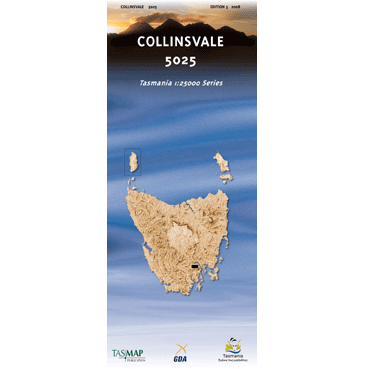
Collinsvale 1:25k Topo Map
The Collinsvale 1:25,000 Topographic Map covers an area west of Hobart, including Mount Wellington summit.
Towns/communities on this map: Lachlan, Collinsvale, Brookside, Chigwell, Berriedale, Rosetta, Springdale and Fairy Glen
Features on this map: Jefferys Track (Northern part – See Longley 1:25,000 for the southern part) Mount Patrick, Trestle Mountain, Collins Bonnet, Mount Marian, Mount Charles, Collins Cap, Mount Connection and Mount Arthur.


Reviews
There are no reviews yet.