Description
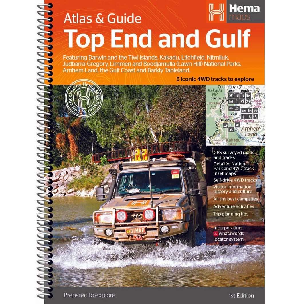
Top End & Gulf Atlas & Guide
The Top End & Gulf Atlas & Guide from Hema features Hema’s distinctive and informative maps, all of which have been field checked by Hema’s Map Patrol team using the latest mapping data to ensure the best possible accuracy.
Written and researched by Chris Whitelaw, this guide provides extensive and information on the whole Top End and Gulf region, featuring Darwin and the Tiwi Islands; Kakadu, Litchfield, Nitmiluk, Judbarra-Gregory, Limmen and Boodjamulla (Lawn Hill) National Parks; Arnhem Land; the Gulf Coast and Barkly Tableland.
Extensive cultural information and stories, along with historical tales from both the Indigenous and European development of the region, provide prospective travellers a new and exciting way to learn about this unique part of the world.
With comprehensive details on towns, national parks, accommodation options, beaches, attractions, five famous 4WD trips, pre-trip planning and much more, you can be sure you will have all the information you require for an enjoyable, interesting and exciting foray into the incredible northern regions of Australia.
Key Features
- Map Patrol surveyed roads and tracks
- Detailed National Park and 4WD track inset maps
- Self-drive 4WD tracks
- Visitor information, history and culture
- All the best campsites
- Adventure activities
- Trip planning tips
Map Content
- 2x Key Maps – inside front cover & start of atlas section
- 24x Inset Maps
- 8x Overview maps – 4WD & Regions


Reviews
There are no reviews yet.