Description
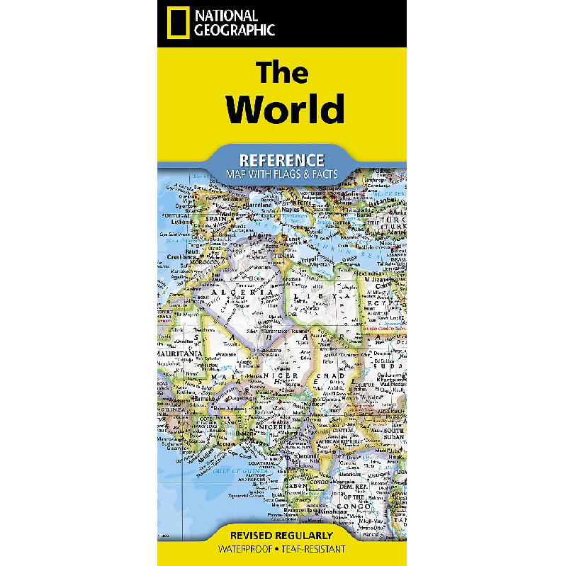
The World Reference Map with Flags and Facts
Expertly researched and designed, National Geographic’s World Reference Map with Flags & Facts is the authoritative map of the world by which other reference maps are measured. The folded world map is designed for travel and durability and features:
- Signature Classic style map with bright, easy to read colour palette with blue oceans and colourful borders
- Background shows mountain ranges and valleys in subtle shaded relief with mountain ranges labeled
- Major water bodies including rivers, lakes, glaciers, oceans, seas, gulfs, bays, straits, and bathymetry
- Clearly defined international boundaries, cities, islands, airports, and physical features
- Thousands of place names carefully and artfully placed to maintain legibility in heavily populated areas
- Up-to-date international boundaries and territorial control reflect de facto status on the ground
- Meticulously researched using multiple authoritative sources including the U.N., U.S. Board on Geographic Names, and policies of individual governments.
- Accurate place names use a combination of conventional English names, official national names, and standard transliterations for non-Latin alphabets.
- Drawn in Winkel Tripel projection with distortions minimized unlike other World maps (e.g. Greenland is shown the same size as Argentina, not South America)
- Corner inset maps feature vegetation, land use, population density, and north and south polar regions
- National facts and flags with each country’s area, population, capital city, GDP per capita, and flag
The map is printed in the USA on durable waterproof, tear-resistant synthetic paper to withstand repeated folding.
Reviews
There are no reviews yet.