Description
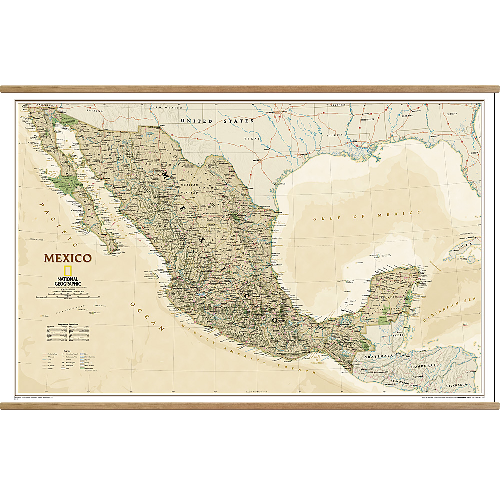
Mexico Executive Wall Map
This Mexico Executive Wall Map is one of the largest and most detailed maps of the country. It features thousands of place names, accurate political boundaries, national parks including Cumbres de Monterrey National Park, biosphere reserves including El Vizcaino Biosphere Reserve, archeological sites including the ruins of the Yucatan Peninsula, and major infrastructure networks such as highways, roads, canals, ferry routes, railroads, oil fields and airports.
Mexico’s diverse terrain is detailed with accurate shaded relief including areas of sand, intermittent and dry lakes, swamps, lava fields and coastal bathymetry. The map is rendered in an antique-inspired colour-palette, making it as stunning as it is informative.


Reviews
There are no reviews yet.