Description
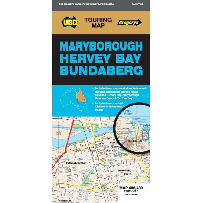
Maryborough Hervey Bay Bundaberg Map 486/480
The latest edition of the Maryborough Hervey Bay Bundaberg Map is a handy tool for both the tourist and locals wanting to find their way around the area. It has been fully revised and updated and includes:
- A regional touring map covering along the coast from Broadwater Conservation Park in the north and Peregian Springs in the south, Inland from Bulburin National Park in the north and Kingaroy in the south, and west to Gayndah, with Fraser Island also included;
- Maps and street indexes for Bundaberg, Hervey Bay and Maryborough;
- Maps of Bargara, Childers, Gayndah, Moore Park Beach, Rainbow Beach and Tin Can Bay;
- A list of regional touring attractions and advertisers.

Reviews
There are no reviews yet.