Description
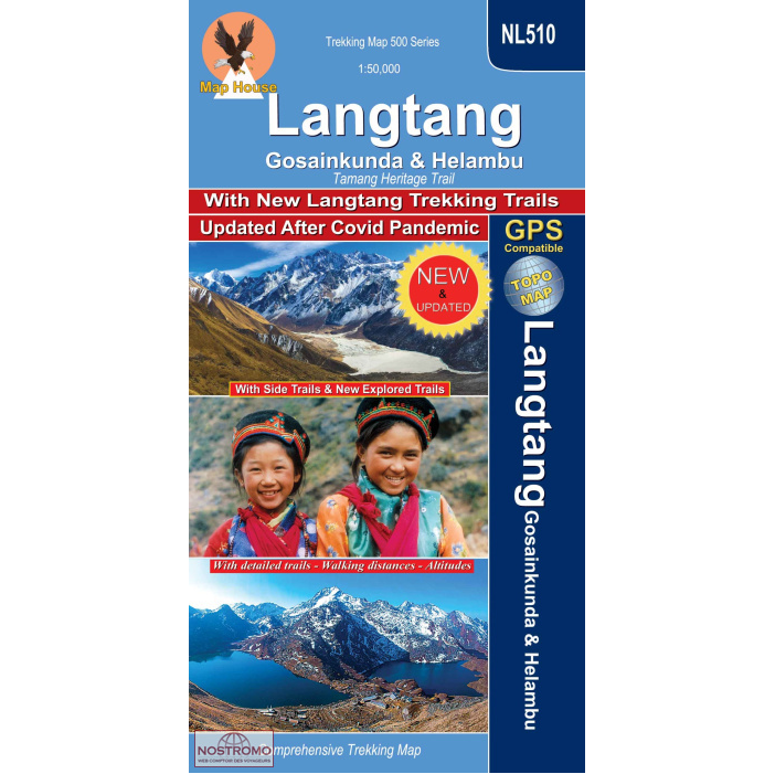
Langtang Nepal Trekking Map (NL510)
This Langtang Nepal Trekking Map NL510 covers Langtang Gosainkunda and Helambu Tamang Heritage Trail in detailed 1:50,000 scale.
The Langtang Gosainkunda and Helambu Tamang Heritage Trail is a trekking route in Nepal that combines the Langtang Valley trek, the Gosainkunda Lake trek, and the Helambu region, including the Tamang Heritage Trail.
The trek typically starts with a drive to Syabrubesi, the gateway to Langtang, and then ascends through the Langtang Valley towards Kyangjin Gompa. After exploring the Langtang Valley, the trail deviates towards Gosainkunda Lake, a high-altitude glacial lake of religious significance. From Gosainkunda, the route descends into the Helambu region, passing through Tamang villages and forests, and eventually reaching Melamchi Bazaar.
With side trails and new explored trails, this comprehensive hiking map also includes detailed trail markings as well as indicators for:
- International Boundaries
- National Park boundaries
- Highways
- Main roads
- Secondary Roads
- Minor Roads
- Main, secondary and minor trail route markings
- Altitudes in meters
The map is fully-indexed, with a detailed legend.
Longitude: 85° 03′ – 85° 55′
Latitude: 27° 40′ – 28° 19′
Altitude Range: 540m – 5130m
Difficulty: Moderate/Strenuous
Days: 8 – 12
Route: Trisuli Bazar, Dhunche, Syabru, Goljung, Parvati Kunda, Gatlang, Thambuchet, Tatopani, Nagthali, Timure, Rasuwagadhi, Briddhim, Lama hotel, Langtang Village, Kyanjin Gompa, Langshisa Glacier, Kanja La, Tarkeghyang, Melamchi Bazar, Kathmandu.


Reviews
There are no reviews yet.