Description
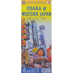
Japan South Railway & Road Map
The Japan South Railway & Road Map from ITMB is a double-sided, waterproof map is a user-friendly map for all of Japan west of Tokyo.
The express Shinkansen lines are coloured differently from the local lines, which are still quite nice and generally are more scenic. The road network is also shown in excellent detail.
Well-known travel spots such as Kyoto and Hiroshima are shown, but western Japan has much more to offer. Nagano, north of Tokyo, or Nagato, to the west, are both now on Shinkansen routes, as well as Kagoshima in the far southwest. From there, local lines wind south and east to the little-visited parts of Japan.
The map, printed on plastic for durability includes insets of Kyoto, Osaka, and Tokyo, as well as island insets of Okinawa and related islands. Map size: 27*39″


Reviews
There are no reviews yet.