Description
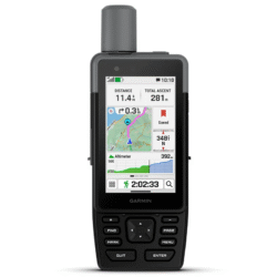
GPSMAP 67
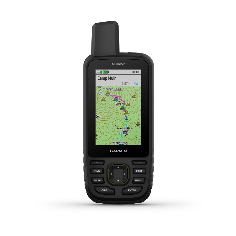
Make more time for adventure with this premium, rugged handheld GPSMAP 67. Get long battery life and multi-band technology for enhanced accuracy plus preloaded TopoActive maps and access to satellite imagery.
Specifications:
| Display Size | 3.8cm x 6.3 cm, 7.6 cm diag |
| Battery type | Rechargeable, internal lithium-ion |
| Display Resolution | 240 x 400 pixels |
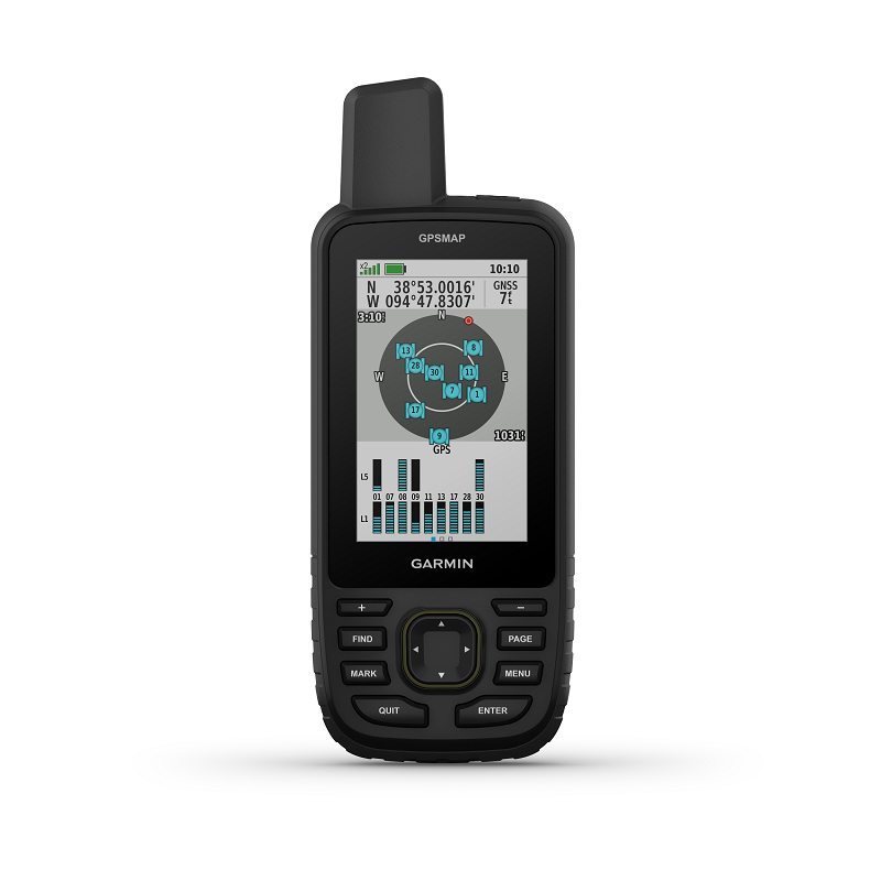
| GPS | Yes |
| Dimension | 6.2cm x 16.3cm x 3.5cm |
| Interface | USB-C |
| Waterproof | IPX7 |
| Weight | 230 g with batteries |
| Display Type | Transflective colour TFT |
| Battery life | Up to 180 hours in default mode Up to 840 hours in expedition mode |
| High-sensitivity receiver | Yes |
Maps & Navigation
| External memory storage | Yes (32 GB max microSD™ card) |
| Waypoints/favorites/locations | 10,000 |
| Preloaded maps | Yes (TopoActive Australia & New Zealand, routable) |
| Basemap | Yes |
| Navigation Routes | 250, 250 points per route; 50 points auto routing |
| Navigation Track Log | 20,000 points, 250 saved gpx tracks, 300 saved fit activities |
| Memory/History | 16 GB (user space varies based on included mapping) |
| Ability to add maps | Yes |
Features
| Send route selection to MapShare during trip | No |
| QZSS | Yes |
| Satellite Imagery | Yes (direct to device) |
| Smart switching between Wi-Fi, Mobile and Satellite with Garmin Messenger app | No |
| Send waypoints to MapShare during trip | No |
| inReach weather | No |
| Active Weather | Yes |
| Contacts | No |
| Rinex logging | No |
| inReach remote widget | No |
| Pairs with Garmin Connect™ Mobile | Yes |
| Touchscreen | No |
| LED beacon flashlight | Yes |
| inReach remote compatible | Yes |
| Sun and moon information | Yes |
| Virtual keyboard for custom messaging | No |
| MapShare compatible with tracking | No |
| IRNSS | Yes |
| Geocaching-friendly | Yes (Geocache Live) |
| Send and receive text messages to other inReach device | No |
| Automatic routing (turn by turn routing on roads) for motorized vehicles | No |
| Send and receive group messages | No |
| GLONASS | Yes |
| Send and receive text messages to SMS and email | No |
| Frequency band | No |
| Displays national, state and local parks, forests, and wilderness areas | Yes |
| Smart notifications on handheld | Yes |
| Connect IQ™ (downloadable watch faces, data fields, widgets and apps) | Yes |
| Custom maps compatible | Yes (500 custom map tiles) |
| Compatible with Earthmate | No |
| Courses | 250, 200 course points per course |
| Dog tracking | No |
| Connections Wireless Connectivity | Yes (Wi-Fi®, Bluetooth®, ANT+®) |
| LiveTrack | Yes |
| Exchange locations with other inReach device | No |
| Vibration alert | No |
| Map segments | 15,000 |
| Point-to-point navigation | Yes |
| Picture viewer | Yes |
| Barometric altimeter | Yes |
| SBAS | No |
| Weather | No |
| XERO™ Locations | Yes |
| Interactive SOS | No |
| VOX (voice activation) | No |
| BeiDou | Yes |
| Ballistics solver | No |
| Automatic routing (turn by turn routing on roads) for outdoor activities | Yes |
| TracBack® | Yes |
| GPS compass (while moving) | Yes |
| Includes detailed hydrographic features (coastlines, lake/river shorelines, wetlands and perennial and seasonal streams) | Yes |
| Multi-band frequency | Yes |
| Includes searchable points of interests (parks, campgrounds, scenic lookouts and picnic sites) | Yes |
| Hunt/fish calendar | Yes |
| Activities | Yes |
| Compass | Yes (tilt-compensated 3-axis) |
| Compatible with Garmin Explore™ app | Yes |
| Tracks | 250 |
| Compatible with Garmin Messenger app | No |
| Galileo | Yes |
| Garmin Pilot™ app compatible | No |
| Garmin Explore website compatible | Yes |
| Area calculation | Yes |
| MIL-STD-810 | Yes (thermal, shock, water); bare unit only |
| Location reporting (send and receive GPS positions) | No |
| VIRB® Remote | Yes |


Reviews
There are no reviews yet.