Description
Freycinet 1:100k Topo Map
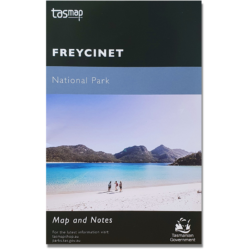
The Freycinet 1:100,000 Topographic Map covers the Freycinet Peninsula and National Park on Tasmania’s East Coast
Other features on this map include Great Oyster Bay, Swansea, Dolphin Sands and Schouten Island.

$9.95
| Edition: | 6th Edition 2008 |
| Sheet No: | 8513 |
| Datum: | GDA94 |
| Scale: | 1:100,000 |
In stock
The Freycinet 1:100,000 Topographic Map covers the Freycinet Peninsula and National Park on Tasmania’s East Coast
Other features on this map include Great Oyster Bay, Swansea, Dolphin Sands and Schouten Island.
| Weight | 0.045 kg |
|---|---|
| Dimensions | 18 × 11.5 × 0.04 cm |
| Options | Unlaminated, Laminated, Hanging Rails |