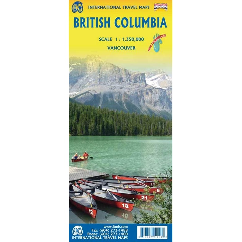
Description
British Columbia Travel Map
The British Columbia Travel Map from ITMB is a double-sided, waterproof map in a 1:1,350,000 scale.
The frontside covers the southern half of BC from the USA Border and as far east to include Calgary, and the revers side continues to the top of the British Columbia border, slightly into Yukon.
British Columbia, Canada’s westernmost province, is defined by its Pacific coastline and mountain ranges. Nature areas like Glacier National Park offer hiking and biking trails, as well as campgrounds. Whistler Blackcomb is a major ski resort that hosted the 2010 Winter Olympics. The scenic Sea-to-Sky Highway links Whistler with Vancouver, a city known for its film industry, at the province’s southern U.S. border.
Notable national parks in BC include:
1. Pacific Rim National Park Reserve
- Location: Vancouver Island
- Highlights: Rugged coastline, temperate rainforests, long sandy beaches (including Long Beach), and the famous West Coast Trail.
- Activities: Surfing, hiking, kayaking, camping.
2. Glacier National Park
- Location: Columbia Mountains, near Revelstoke
- Highlights: Dramatic alpine scenery, over 400 glaciers, and Rogers Pass National Historic Site.
- Activities: Hiking, climbing, backcountry skiing.
3. Yoho National Park
- Location: Canadian Rockies, near the Alberta border
- Highlights: Emerald Lake, Takakkaw Falls, and the Burgess Shale fossil beds (UNESCO World Heritage Site).
- Activities: Hiking, canoeing, wildlife viewing.
4. Kootenay National Park
- Location: Southeastern BC, adjacent to Banff and Yoho
- Highlights: Radium Hot Springs, Marble Canyon, and diverse landscapes from glacier peaks to dry canyons.
- Activities: Hiking, camping, hot springs soaking.
5. Gulf Islands National Park Reserve
- Location: Southern Gulf Islands (between Vancouver and Vancouver Island)
- Highlights: Coastal marine ecosystems, quiet beaches, and rich First Nations history.
- Activities: Kayaking, boating, wildlife viewing.
6. Mount Revelstoke National Park
- Location: Near Revelstoke, BC
- Highlights: Meadows in the Sky Parkway, subalpine wildflowers, and trails from car-accessible viewpoints.
- Activities: Hiking, picnicking, skiing in winter.
7. Gwaii Haanas National Park Reserve and Haida Heritage Site
- Location: Haida Gwaii (Queen Charlotte Islands)
- Highlights: Remote wilderness, ancient Haida totem poles, rainforests, and coastal ecosystems.
- Activities: Cultural tours, kayaking, eco-tourism.
8. Akamina-Kishinena Provincial Park (Note: Though provincial, often mentioned due to its ecological connection to Waterton Lakes National Park)
- Location: Southeastern BC, near Alberta and Montana borders
- Highlights: Unique ecosystem shared with neighbouring national parks.
- Activities: Backcountry hiking, wildlife viewing.
9. South Okanagan—Similkameen National Park Reserve (Proposed, but highly notable)
- Location: Southern BC interior
- Highlights: One of Canada’s most endangered ecosystems (semi-arid desert), with rare species.
- Status: In progress; highly anticipated addition to Parks Canada’s network.
10. Waterton-Glacier International Peace Park (Partially overlaps with BC through ecosystem and watershed significance)
- Location: Primarily in Alberta and Montana, but ecologically connected to BC’s protected lands.
- Highlights: UNESCO World Heritage Site, stunning biodiversity.
- Activities: Hiking, wildlife watching.
The front side of the map also includes an inset map of Downtown Vancouver at 1:9,500 scale.


Reviews
There are no reviews yet.