Description
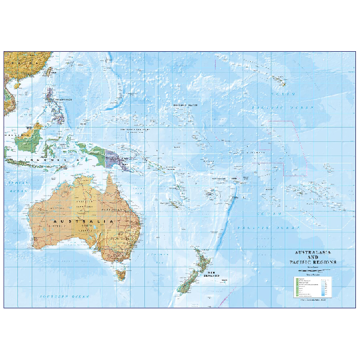
Australia and Pacific Regions Wall Map
This is a political map of Australia and the Pacific Regions on the Van der Grinten projection.
Beautifully coloured, detailed mapping showing country borders both on land and at sea and the International dateline.
All the islands are named along with capitals, mains cities and towns. The map includes hills on land and ocean depths. Ideal for the home or office!



Reviews
There are no reviews yet.