Description
Central Highlands Tasmania Wall Map
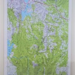
This Central Highlands Tasmania Wall Map is a 1:100,000 scale map composite of four maps from Tasmap’s Topographic series of the same scale.
It gives great detail of the Central Plateau lakes and area and includes 4WD, forestry, and hiking trails and expands greatly on the 1:200,000 Highland Lakes map.
It comes laminated with Tasmanian Oak timber hanging battens attached.
Area covered extends to:
- Westbury in the north east corner
- Hollow Tree in the south east corner
- Lake Cethana in the north west corner
- Prince of Wales Range in the southwest
Maps incuded:
This product is made to order, please allow extra time for completion. :-)


