
Description
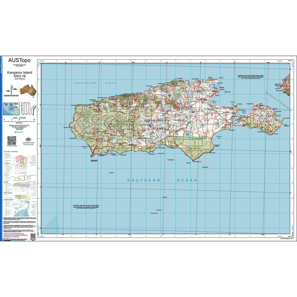
Kangaroo Island 1:250k Topo Map SI53-16
The Kangaroo Island 1:250k Topo Map SI53-16 is ideal for outdoor enthusiasts, professionals, and planners alike. Produced to high cartographic standards, these maps are a reliable and practical companion for anyone needing an in-depth understanding of the terrain.
To support accurate navigation and route planning, each map clearly depicts:
- Contour lines at 50m intervals
- Elevations
- Rivers and creeks
- Vegetation
- Walking tracks
- Fire trails
- Roads
- Man-made and natural features
- Landmarks
- Place names
Suitable for:
- 4WDing and trip planning
- Surveying
- Environmental studies
- Emergency planning
Whether you’re planning your next adventure or working in the field, this map is an indispensable tool for navigating Australia with confidence.
We print these maps in store, and they can come folded or flat, and both laminated and unlaminated – laminated maps still fold.
Index available here: 250k Topographic Map Index
Available in store and online at Geographica .

Reviews
There are no reviews yet.