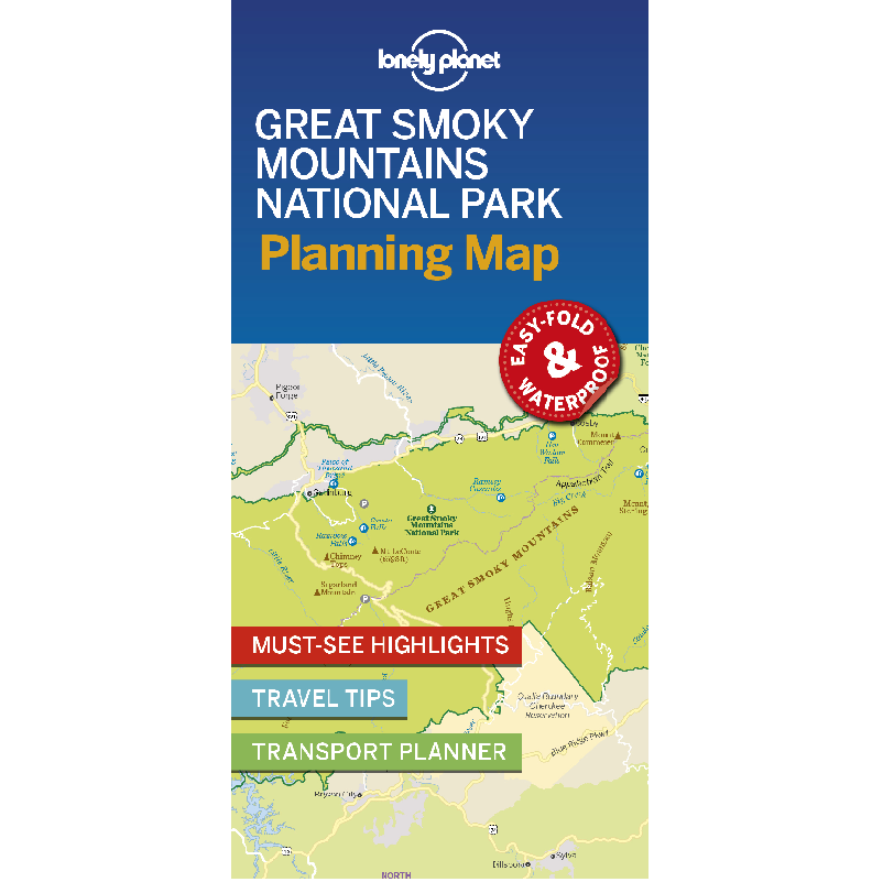
Description
Great Smoky Mountains National Park Planning Map
Durable and waterproof, with a handy slipcase and an easy-fold format, Lonely Planet’s Great Smoky Mountains National Park Planning Map helps you get around with ease.
Get more from your map and your trip with images and information about top attractions, itinerary suggestions, a transport guide, planning information, themed lists and practical travel tips.
- Durable and waterproof
- Easy-fold format and convenient size
- Handy slipcase
- Full colour and easy to use
- Before-you-go info
- Beautiful imagery
- Tailored itineraries
- Can’t-miss regional highlights
- Detailed town index
- Transport planner
- Themed lists
Covers Noah ‘Bud’ Ogle Nature Trail, Grotto Falls, Home of Ephraim Bales, Alfred Reagan Place, Place Of A Thousand Drips, Chimney Tops, Alum Cave Bluffs, Newfound Gap, Oconaluftee Valley Overlook, Mingus Mill, Sugarlands Visitor Center, Metcalf Bottoms Picnic Area, Townsend Wye, Great Smoky Mountains Institute At Tremont, Cades Cove.


Reviews
There are no reviews yet.